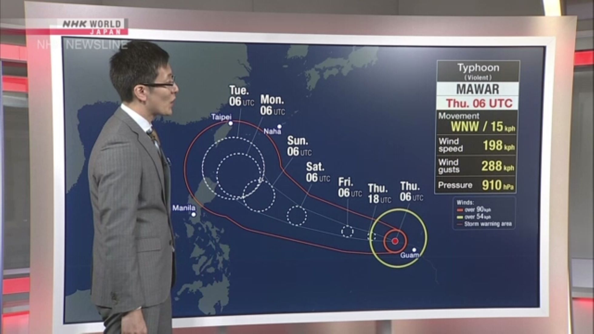

TOKYO, May 28 (NNN-NHK) – Japan’s weather agency, said yesterday that, Typhoon Mawar is likely to approach the south-western prefecture of Okinawa as early as next Tuesday.
As of 3.00 p.m. local time yesterday, the Japan Meteorological Agency (JMA) reported that, Typhoon Mawar was moving westward at a speed of 25 km per hour, in the waters east of the Philippines.
It is expected to gradually decelerate, as it moves over the sea, eventually turning north and possibly approaching the Okinawa islands, as early as Tuesday, bringing high waves to the Okinawa and Amami regions, according to the JMA.
The Sakishima Islands in Okinawa could face intense winds from around Tuesday, depending on the storm’s trajectory, it added.
Moist air from the typhoon might intersect with a rain front, projected to progress from the Sea of Japan to the Pacific side, leading to an extended period of heavy rainfall across eastern and western Japan, according to the weather agency.
It advised the public to check hazard maps and seek shelter in preparation for the upcoming rainy season.
Mawar, the season’s second named storm and first typhoon, yesterday possessed a central atmospheric pressure of 925 hectopascals, packing winds of up to 180 km per hour near its centre, said the JMA, adding that, its maximum wind gusts reached 252 km per hour.
Gale-force winds are exceeding 90 km per hour within a radius of 185 km from the typhoon’s centre, it said.– NNN-NHK